
About LA Harbor Habitats
ON THIS PAGE:
Balancing the needs of international trade with the protection
of the
natural resources of Los Angeles Harbor
The Port of Los Angeles is America’s Port®, the nation’s premier gateway for international commerce and the busiest seaport in the Western Hemisphere. Located in Los Angeles Harbor on San Pedro Bay, 25 miles south of downtown Los Angeles, the Port encompasses 7,500 acres of land and water along 43 miles of waterfront.
For the last decade, the Port has also been at the forefront of revitalization of the LA Waterfront, improving public access to the water, developing public-friendly amenities and infrastructure, and transforming the harbor shoreline into a world-class visitor destination. The Port also supports abundant marine life in a variety of habitats: from the pelagic habitat (the open water column); the soft-bottom habitat (the sand and mud harbor bottom, beaches, and eelgrass beds); and the riprap and piling habitat (rocky shoreline, pier pilings, and kelp beds).
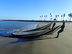
The Port of Los Angeles, in cooperation with the neighboring Port of Long Beach, conducts “Biosurveys” every five years. Biological resources are monitored over an entire year at more than 40 points throughout the two Ports. The latest 2023 Biosurvey, conducted from April 2023 to March 2024, involved dozens of scientists and technicians who collected and analyzed samples of fish eggs and larvae, adult and juvenile fish, bottom-dwelling animals in the sediments, and scrapings of rocks and pilings. They also conducted diver surveys, measured the kelp and eelgrass beds, conducted bird surveys, and noted marine mammals in the harbor. Over 46,000 fish were collected, 66,000 bird observations were made and over 85,000 tiny animals were separated from sediment and scraping samples and then identified and weighed.
This biological monitoring program has been designed to be comparable with ongoing long-term regional monitoring programs that survey habitat quality and biological communities in other embayments, such as San Diego Bay, and coastal habitats throughout Southern California.
Method Highlights
Satellite Imagery
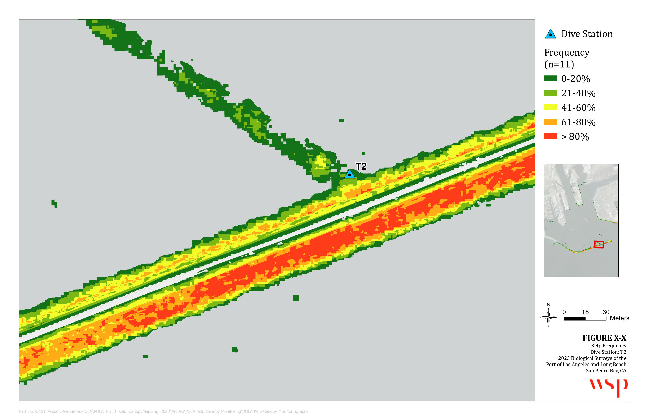
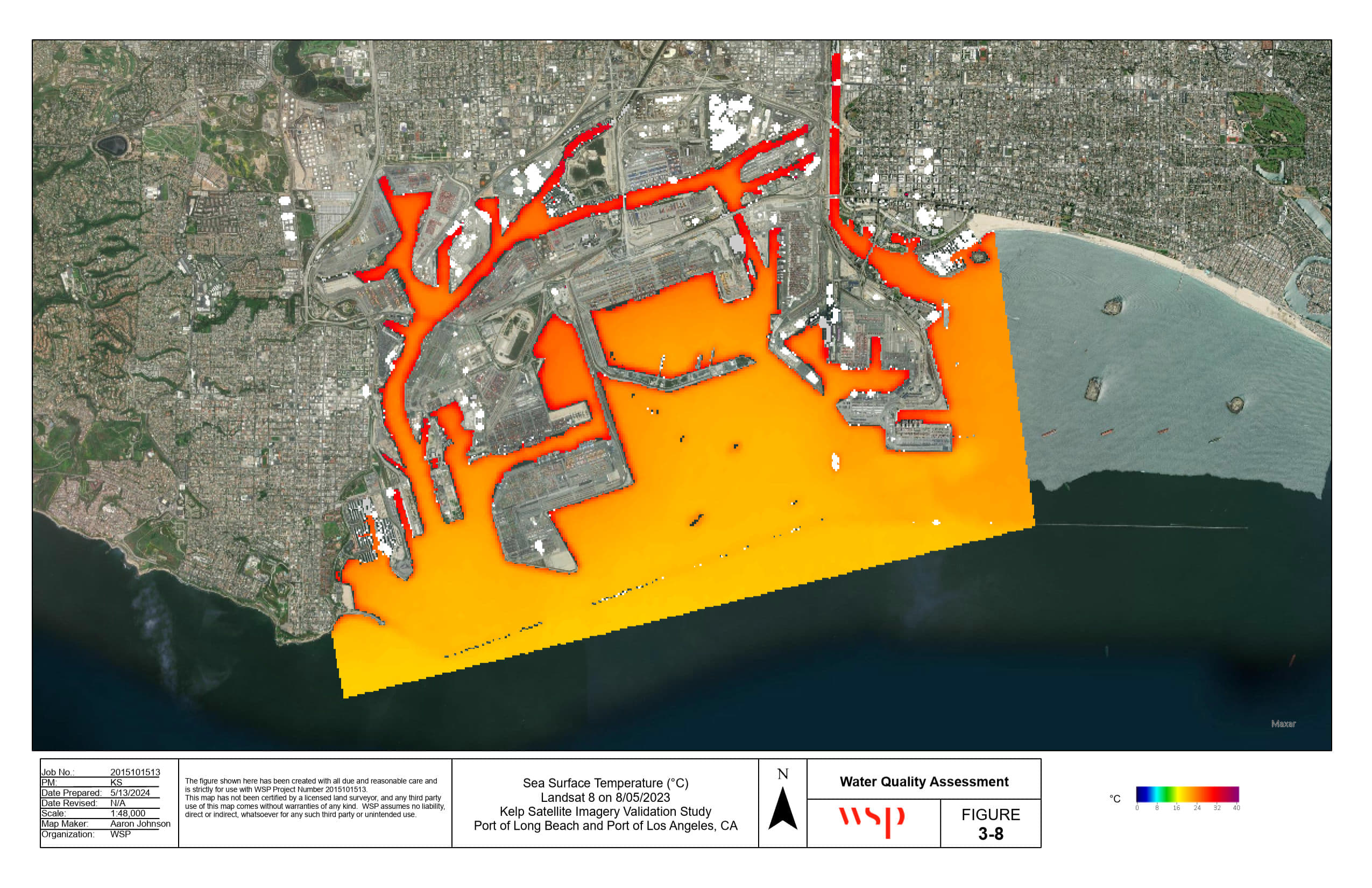
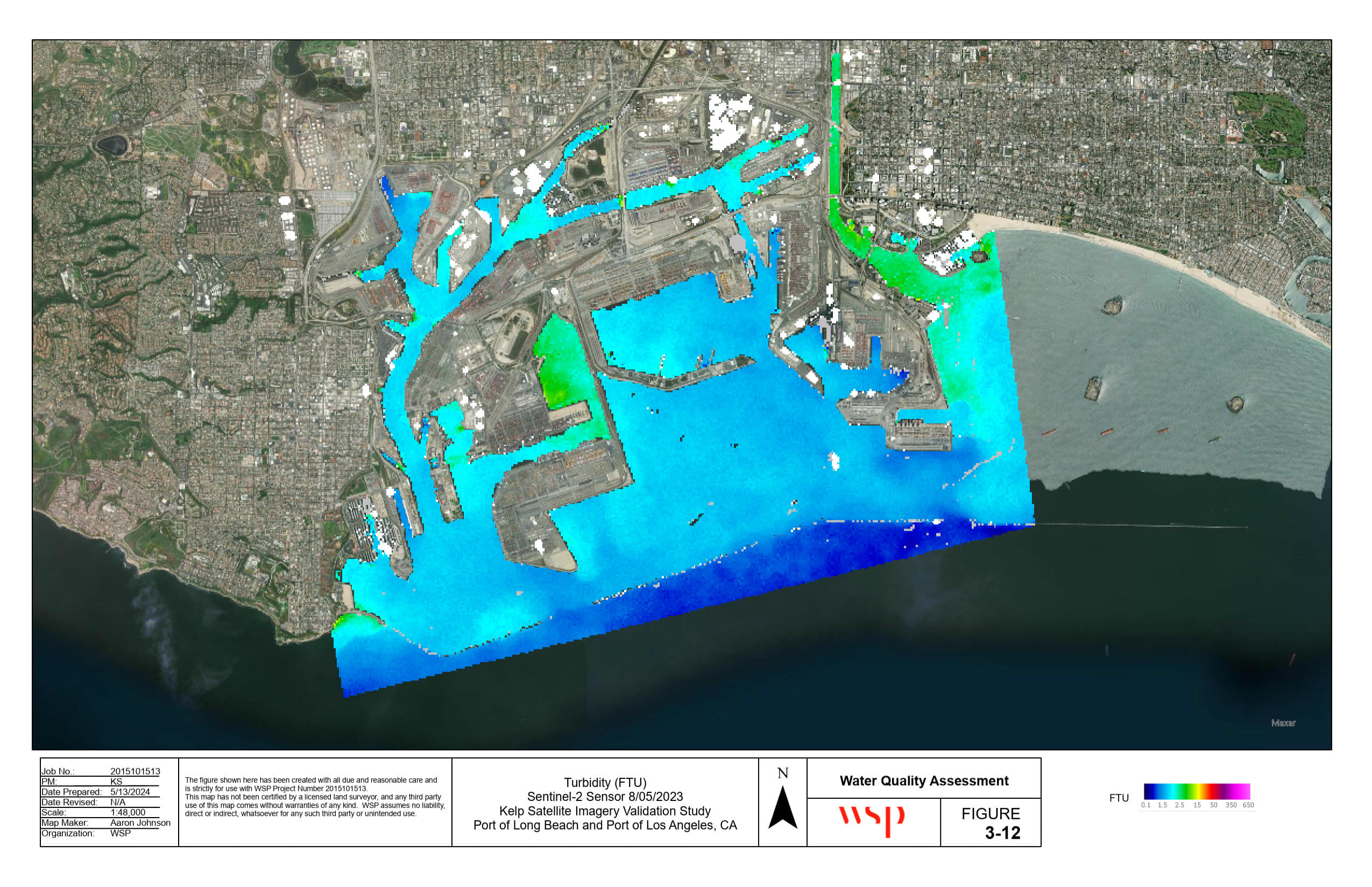
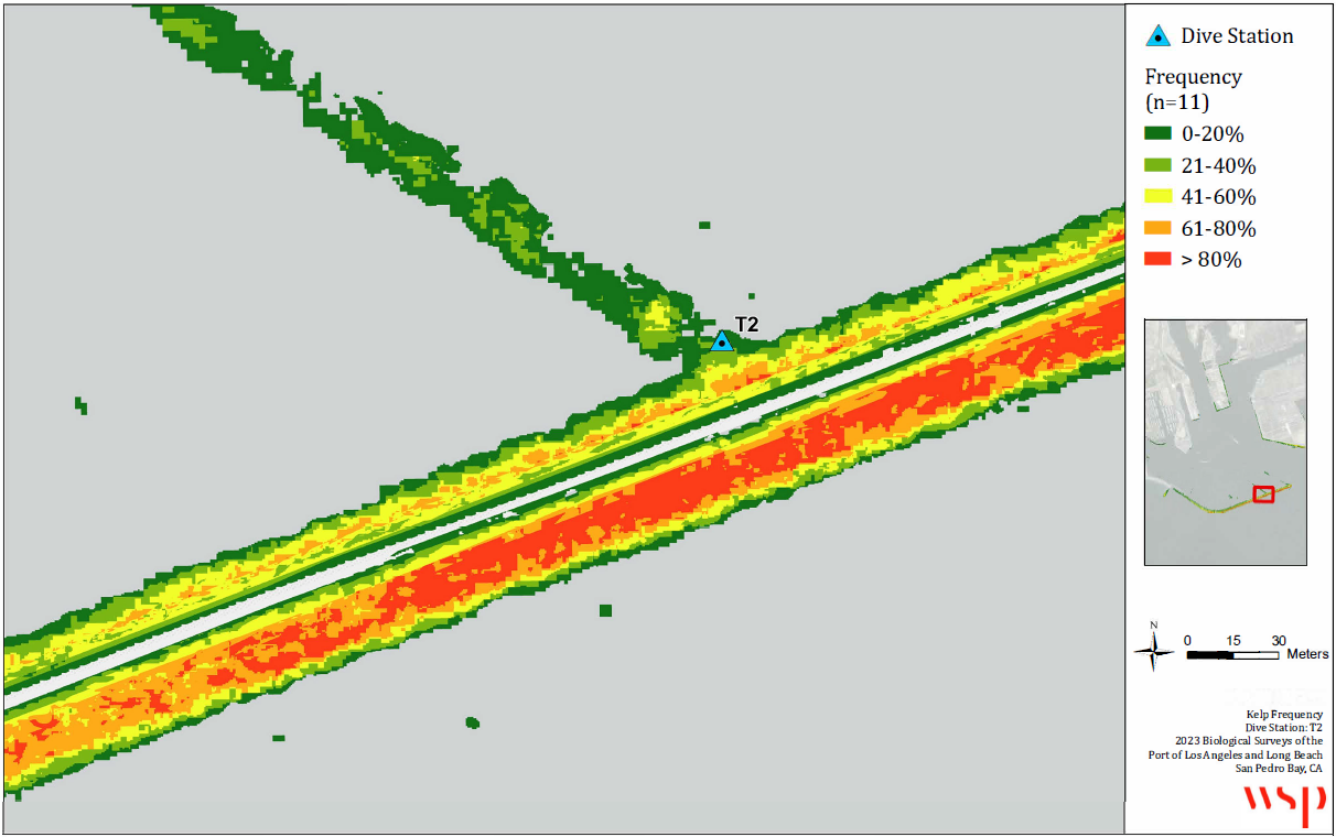
As part of Biosurveys, the Ports map kelp canopy present on riprap embankments and the federal breakwater. The 2023 Biosurvey is the first to use high resolution imagery from commercial satellites to estimate kelp canopy in the Port Complex. In addition to mapping this critical habitat, monthly water quality parameters such as sea surface temperature, chlorophyl-a, and water clarity were also measured using satellite imagery, providing a port-wide look at physical characteristics that affect habitat and species distribution. Archived imagery from 2018 was also available for kelp canopy and water quality parameters, allowing for comparisons between the two most recent survey years.
Photos to the right: Kelp frequency at dive station T2; Sea surface temperature August 2023; Turbidity August 2023.
Kelp Frequency at Dive Station T2
Sea Surface Temperature – August 2023
Turbidity – August 2023
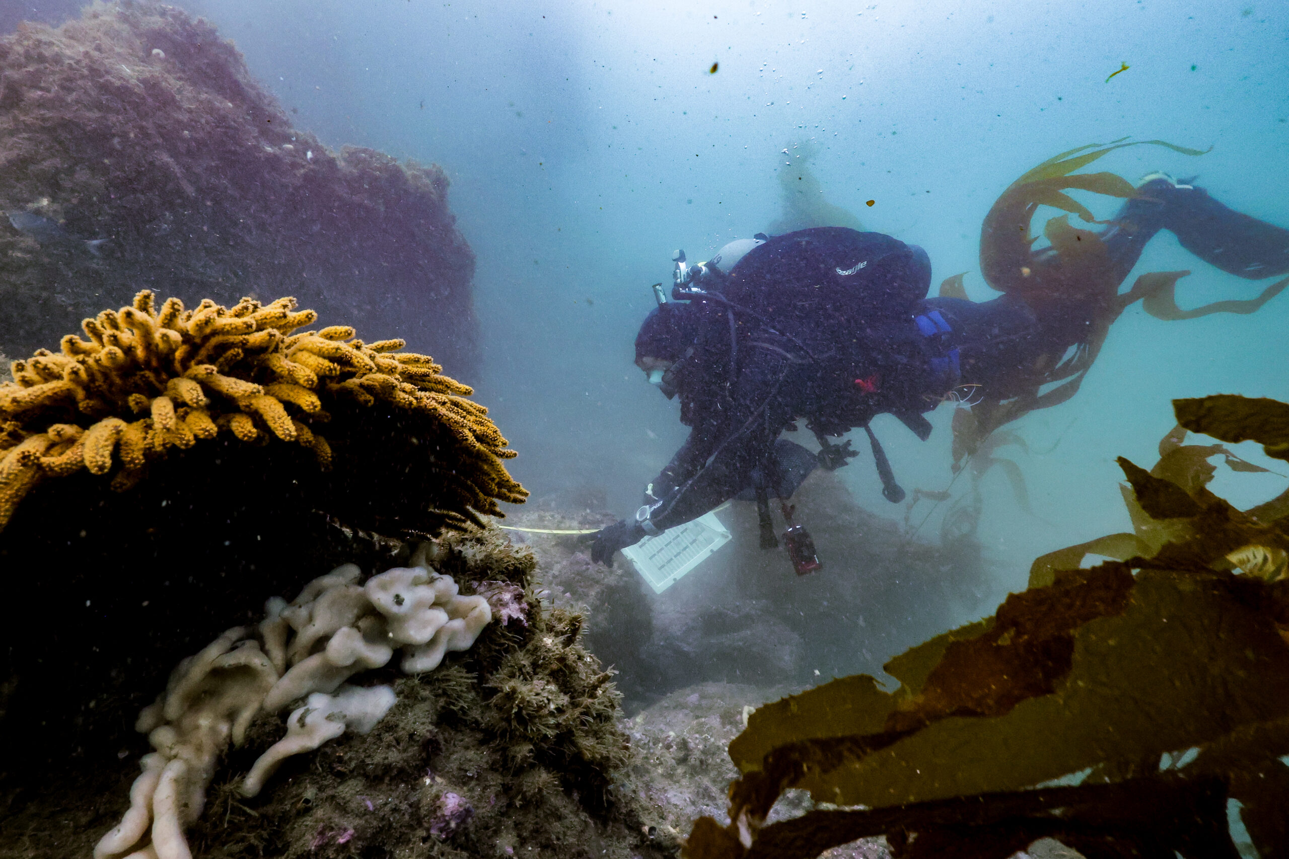
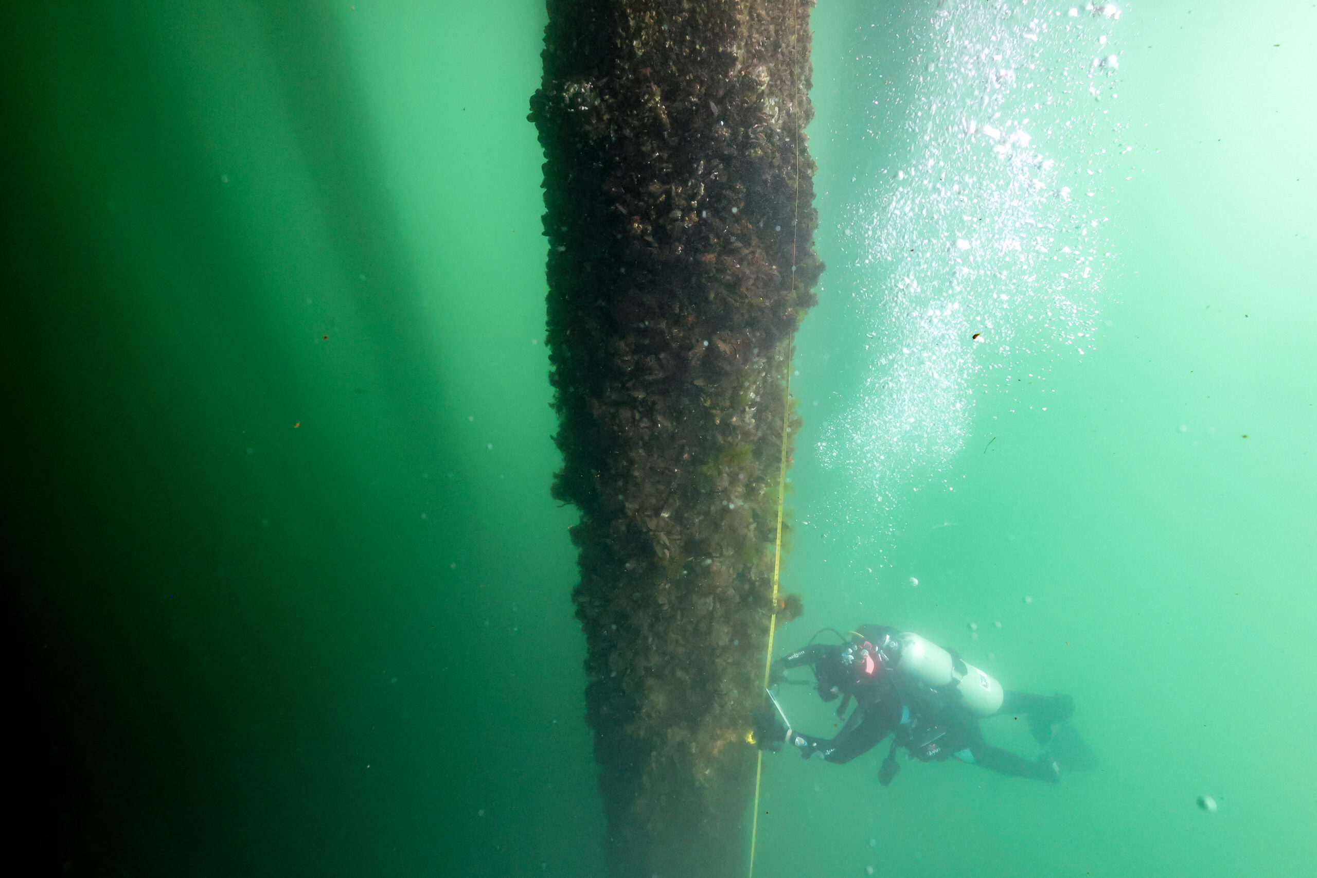
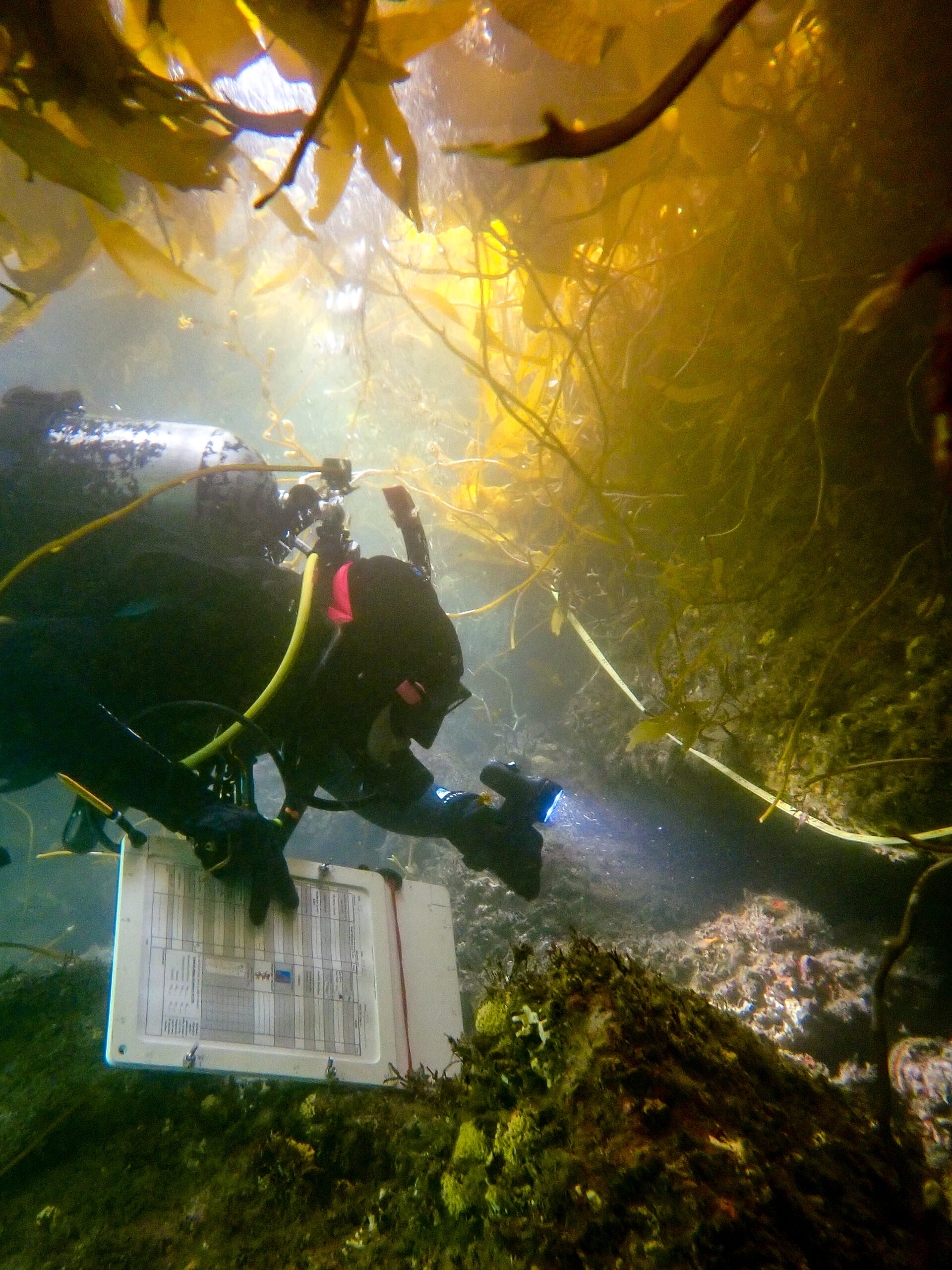
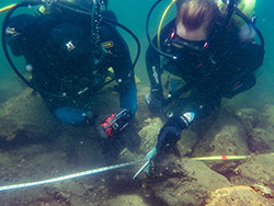
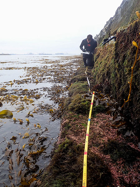
Dive Surveys
The 2018 and 2023 Biosurveys incorporated new visual diver survey methods similar to those used in regional rocky reef monitoring to characterize fish, invertebrates and algae communities on riprap embankments, the federal breakwater, and concrete pilings. These dive surveys have found over 40 species of fish utilizing these habitats, including over a dozen reef-associated fish catalogued for the first time in the Port Complex.
The dive surveys have better characterized the distribution of kelp habitat and the presence of other protected species in the Port Complex such as green and pink abalone and the discovery of an endangered white abalone in 2018. The novel application of rocky reef monitoring methods on artificial structures allows for more rigorous comparison of the communities observed to nearby natural reefs, offshore oil and gas infrastructure, and existing coastal rocky reef mitigation projects to guide future Essential Fish Habitat recommendations.
Photos near text: Piling survey; Riprap survey; Fish survey
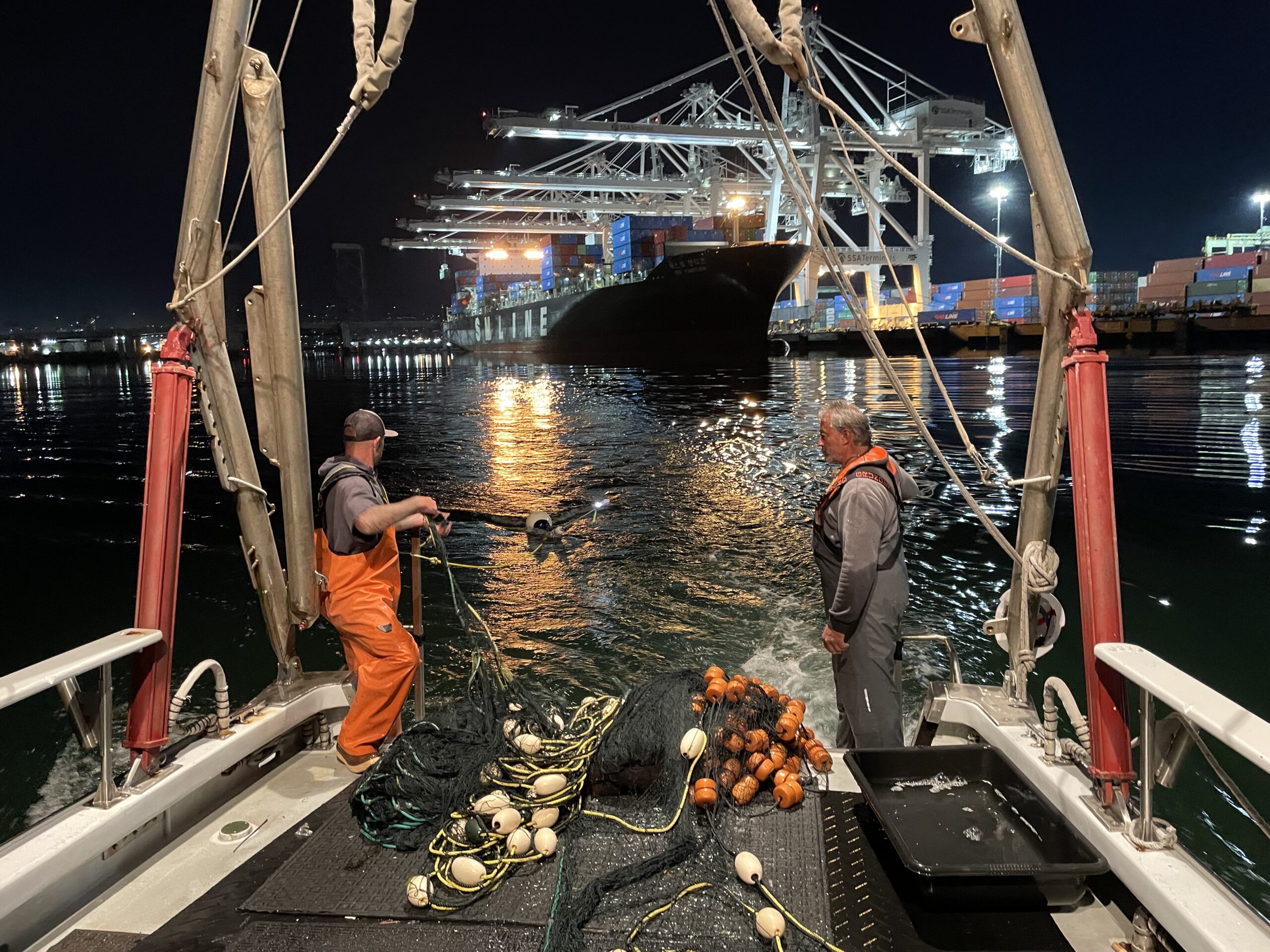
How Do We Sample Underwater Habitats in the Harbor?
How do we collect data on the animals that live underwater? Watch the video to find out more!
Photos
Check out the photos below of our sampling crews in action on the
Biosurvey Study! (Select the photos to enlarge)


Storymaps and Brochures
To learn more about the 2023 surveys, select the buttons below:

BROCHURE:
San Pedro Bay: A Look Beneath the Surface

STORYMAP:
Port habitats: What makes them diverse?
STORYMAP:
How do we sample harbor habitats?
STORYMAP:
Dynamic environments: the cycles and rhythms of San Pedro Bay
Location
425 South Palos Verdes Street
San Pedro, CA, USA 90731
Phone: (310) 732-3508
Email: community@portla.org


